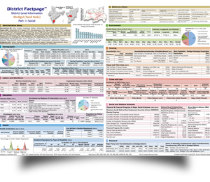
The same 620 Indian districts as the Factbook series — but condensed to two A3 sheets per district. Headline figures at a glance: demographics, sector indicators, scheme delivery and infrastructure. Designed for desk reference, field officers and classroom use.
Population, literacy, sex ratio, household count, decadal growth — the demographic snapshot a planner, journalist, or student would want at first glance.
Top band — district name, parent state, FactPage™edition number and a brief on the district's administrative composition (Tehsils, blocks, headquarters town).
Roads, railway, banks, schools, hospitals — counts and densities. The “is this district served?” panel that field officers and consultants reach for first.
Visual bars for agriculture, industry, banking, health, education — the district's standing on each, benchmarked against state and national averages.
Every number on the sheet is foot noted with its primary source. The methodology link directs to the parent District Factbook for the full apparatus.
Compact table for the major central schemes — NREGA person-days, PMAY houses sanctioned, JSY beneficiaries, PM-Kisan disbursements — the year's headline numbers.